LiveCamera


 Jakość Powietrza


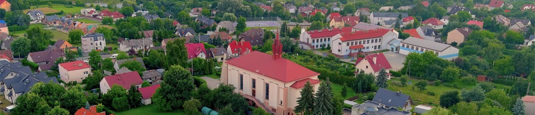


With over 25,000 inhabitants, the Gmina of Zabierzów is one of the biggest Gminas in the Malopolska Province. Located in the immediate vicinity of Krakow, it covers an area of 99.6 km2. The Gmina has a rich history, scenic Jurassic landscapes and also a modern technical infrastructure. Its safety, high living standards and good investment conditions make it an attractive region for its inhabitants, tourists and investors.
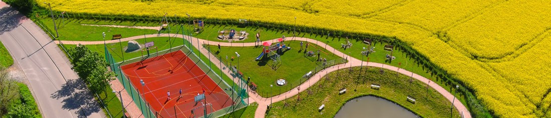
The Gmina’s continuous dynamic development is mostly driven by a very good and convenient road connection from the centre of Krakow. is KrakowInternationalAirport, an A4 highway toll station and railway infrastructure are located here. The Gmina of Zabierzów has valid land zoning, a well-developed road infrastructure, a water supply network, sewerage, gas and power line systems, a modern education infrastructure and a local culture centre with a wide range of interests for children, youth and adults. The Gmina can also boast a very rich sports and leisure infrastructure. You will find a sports and leisure centre here, with an indoor swimming pool and a sports and entertainment hall for 260 people, a modern sports stadium, horse studs, tennis courts, many climbing spots and scenic tourist trails. Taken together, these factors are encouraging a rapid growth in the number of the Gmina’s inhabitants, tourists and investors. Thanks to a modern management and open climate of both the Gmina’s authorities and its inhabitants, the Gmina of Zabierzów is regarded as an attractive place with great prospects for dynamic and sustainable development.
Galeria

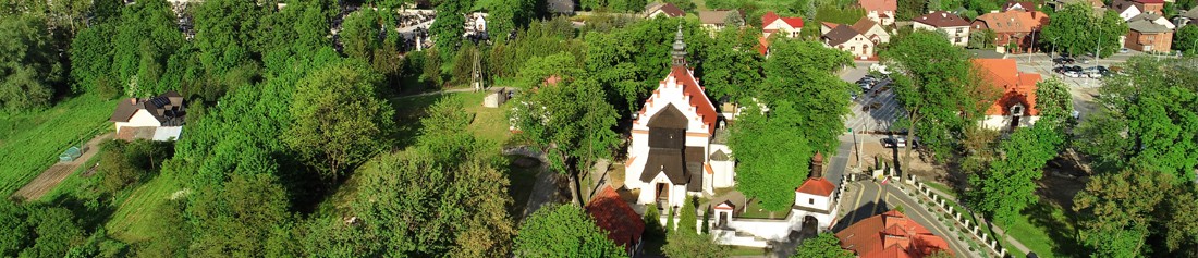
Rynek w Zabierzowie

Rynek w Zabierzowie

Dolina Bolechowicka

Balice

Bolechowie

Więckowice

Dolina Kobylańska

Rząska

Dolina Kobylańska

Radwanowice

Rudawa

Nielepice

Zabierzów

Rynek w Zabierzowie

Rynek w Zabierzowie

Rynek w Zabierzowie

Dolina Kobylańska

Dolina Bolechowicka
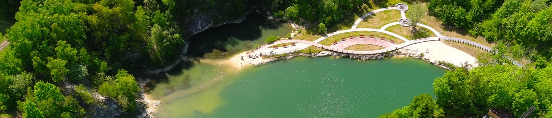
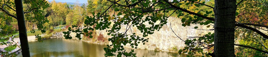
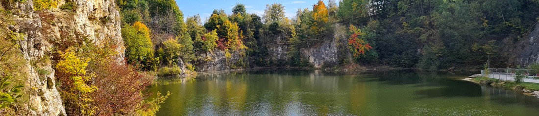
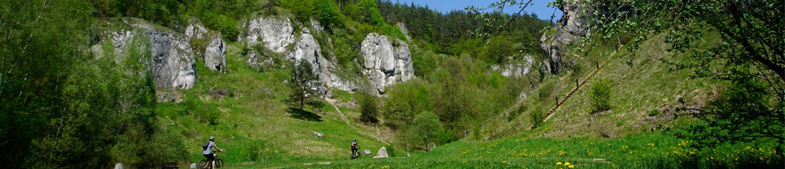
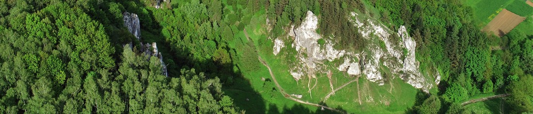
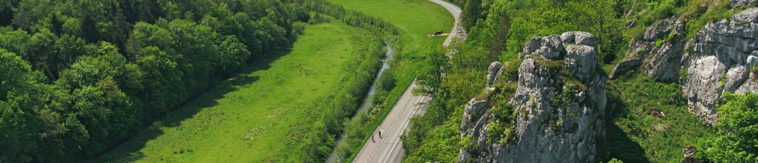
The Gmina of Zabierzów is marked by a varied topography as it is located at the junction of three mesoregions of the Polish Jura Chain: the Olkusz Upland, the Krzeszowice Trench and the Tenczynek Prominence. The average height of the Olkusz Upland, also called the Ojców Plateau, is 400m above sea level. The upland goes down to the Krzeszowice Trench with a series of distinct faults in the form of steep and almost 100-metre high rock steps. From the south the upland’s gently rolling hilltops cut numerous stream valleys which form winding and rocky gorges, commonly known as the KrakowValleys. The map shows the SzklarkaValley, BędkowskaValley, KobylańskaValley, BolechowickaValley (the last two located in the Gmina of Zabierzów; probably most known and frequently visited) and the KluczwodaValley, which is situated further to the west. A similar topography is found in the Tenczynek Prominence, which is the biggest trunk hill in the Krakow region. Its plateaux, which usually rise up to 300m above sea level, go down to the Krzeszowice Trench in steep rock steps and are cut by numerous valleys, of which some are dead (e.g. Mardi Gras Hole, Kochanowski Gorge, Zbrza Gorge). The eastern parts of the Tenczynek Prominence, which lie within the Gmina of Zabierzów, are covered by the ZabierzówForest, which is one of the biggest forests in the region of Krakow. The mesoregions listed above are divided by a tectonic hollow of the Krzeszowice Trench (several kilometre wide), which has a relatively flat surface. Along the bottom of the Krzeszowice Trench runs the RudawaRiver, which turns southwards after passing Zabierzów, thus forming a gorge through the Tenczynek Prominence at the legendary Kmita’s Rock.
The geological composition of this area largely consists of Upper Jurassic limestone. These rocks (the remains of the deposited shells and skeletons of different organisms, such as crustacea, mussels, coelenterates, lampshells), are mostly made of calcium carbonate. They were formed in the warm and relatively shallow sea which covered the Polish Jura Chain about 160 million years ago. In the region of Krakow the Upper Jurassic limestone forms a 300-metre thick complex which shows much lithologic variety.
In this area rocky limestone is the most typical. Being most resistant to erosion, it was formed from other types, thus creating the rocks typical of the Polish Jura Chain, both in plateaux and in valleys. During the formation of the current land composition, after the last sea had withdrawn in the Upper Cretaceous period (80 million years), the alpine orogenic movements of the Tertiary period, in the Miocene (23 million years) to be precise, had the greatest influence on the current shape. The overlapping of the folding Carpathian Mountains onto the stiff plate of the Polish Jura Chain made it crack into different sized blocks and the mountains’ movements along the plates of the faults led to the formation of horsts, including the Tenczynek Prominence and the Krzeszowice Trench, a tectonic hollow. About 15 million years ago the Krzeszowice Trench was covered by sea, which left thick layers of argillaceous deposits. Beneath these were formed the faults which can be found on the edges of the Tenczynek Prominence. Today they appear as steep, rocky and ragged morphological steps. After the end of the Tertiary the formation of the valleys as we can see them today began. At first streams ran directly towards the Vistula River through the Krzeszowice Trench and Tenczynek Prominence, so carving their channels through soft Mioceneous residues. After reaching a harder substratum – and also as a result of the lowering of the level of the Vistula River – they were pulled eastwards and connected to form the Rudawa Valley. The lower parts on the Tenczynek Prominence were abandoned and in some cases reused by smaller flows, such as Sanka and Brzoskwinka. In the Quarternary i.e. the contemporary period in the Earth’s history (from 1.8 million years), the composition of the land took its current form. Older structures were largely covered by glacial deposits, such as loess on plateaux and hillsides, and sands were blown at the end of the glacial period (15 – 12 thousand years ago). A very important role in the formation of the land is played by karst effects, which involve the dissolution of carbonate rocks by rainwater. As a result karst springs, sink holes, drainless basin areas (e.g. in the Będkowska Valley), the typical local rock composition and, most importantly, numerous caves and rock shelters came into being. The geological composition can be explored further by following the red walking and educational trail. It passes through two old quarries in Zabierzów, where you can see different types of limestone which fill karts forms and Tertiary deposits and cut the rock faults.